![](/images/other/stat-length.png)
![Excursión A pie Winkel (Eifel) - HeimatSpur Apolloniaweg - Photo](https://media.geolcdn.com/t/1900/400/ext.pjpeg?maxdim=2&url=https%3A%2F%2Fstatic1.geolcdn.com%2Fsiteimages%2Fupload%2Ffiles%2F1545311037marcheuse_200dpi.jpg)
HeimatSpur Apolloniaweg
SityTrail - itinéraires balisés pédestres
Tous les sentiers balisés d’Europe GUIDE+
![Longitud](/images/other/stat-length.png)
Longitud
13,9 km
![Altitud máxima](https://static1.geolcdn.com/siteimages/upload/files/1508320355ic_sort_altitude_max_24dp.png)
Altitud máxima
499 m
![Desnivel positivo](https://static1.geolcdn.com/siteimages/upload/files/1508320355ic_sort_den_pos_24dp.png)
Desnivel positivo
335 m
![Km-Effort](/images/other/stat-length.png)
Km-Effort
18,3 km
![Altitud mínima](https://static1.geolcdn.com/siteimages/upload/files/1508320355ic_sort_altitude_min_24dp.png)
Altitud mínima
351 m
![Desnivel negativo](https://static1.geolcdn.com/siteimages/upload/files/1508320355ic_sort_den_neg_24dp.png)
Desnivel negativo
334 m
![Boucle](https://static1.geolcdn.com/siteimages/upload/files/16400158638029165_repeat_loop_refresh_sync_direction_icon.png)
Boucle
Sí
Baliza
Fecha de creación :
2022-02-11 20:53:40.731
Última modificación :
2022-02-11 20:53:40.731
![A pie](https://static1.geolcdn.com/sitytour/trail-icons/100.png)
4h10
Dificultad : Fácil
![Escanee este código QR para abrir la excursión en la aplicación SityTrail](https://capi.geolives.com/qq0zvz2zws4bq2lad0pu/sitytour/trails/3102306/qr.png?size=200)
Aplicación GPS de excursión GRATIS
A propósito
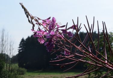
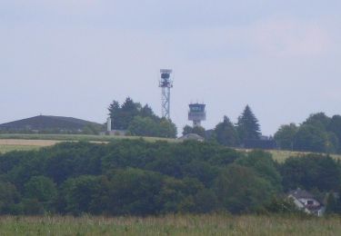
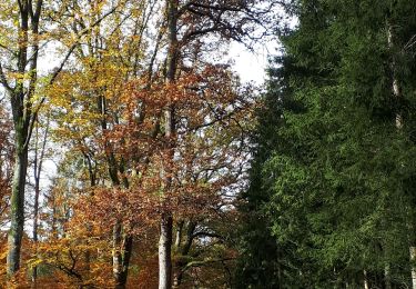
Ruta A pie de 13,9 km a descubrir en Renania-Palatinado, Landkreis Vulkaneifel, Winkel (Eifel). Esta ruta ha sido propuesta por SityTrail - itinéraires balisés pédestres.
Descripción
Trail created by Eifel Tourismus.
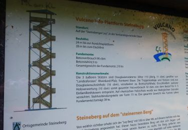
Symbol: grünes rechteck mit AP in weißer Schrift
Localización
País:
Germany
Región :
Renania-Palatinado
Departamento/provincia :
Landkreis Vulkaneifel
Municipio :
Winkel (Eifel)
Localidad:
Unknown
Salida:(Dec)
Salida:(UTM)
353798 ; 5556988 (32U) N.
Comentarios
Excursiones cerca
![Excursión A pie Steineberg - HeimatSpur Keltenrundweg - Photo](https://media.geolcdn.com/t/375/260/4b1692aa-f11b-4d67-8202-607607da5a44.jpeg&format=jpg&maxdim=2)
![A pie A pie](https://static1.geolcdn.com/sitytour/trail-icons/100.png)
HeimatSpur Keltenrundweg
A pie
Medio
Steineberg,
Renania-Palatinado,
Landkreis Vulkaneifel,
Germany
![](/images/other/stat-length.png)
15,4 km | 20 km-effort
4h 36min
![](https://static1.geolcdn.com/siteimages/upload/files/16400158638029165_repeat_loop_refresh_sync_direction_icon.png)
Sí
![Excursión A pie Strohn - Rundweg Strohner Schweiz - Photo](https://media.geolcdn.com/t/375/260/0d85f9aa-8c27-4f78-b3f2-bfe04930aefe.jpeg&format=jpg&maxdim=2)
![A pie A pie](https://static1.geolcdn.com/sitytour/trail-icons/100.png)
Rundweg Strohner Schweiz
A pie
Fácil
Strohn,
Renania-Palatinado,
Landkreis Vulkaneifel,
Germany
![](/images/other/stat-length.png)
3,8 km | 4,6 km-effort
1h 2min
![](https://static1.geolcdn.com/siteimages/upload/files/16400158638029165_repeat_loop_refresh_sync_direction_icon.png)
Sí
![Excursión A pie Strohn - HeimatSpur Lavaweg Strohn - Photo](https://media.geolcdn.com/t/375/260/f09be04d-a256-4442-9159-f0968e97baeb.jpeg&format=jpg&maxdim=2)
![A pie A pie](https://static1.geolcdn.com/sitytour/trail-icons/100.png)
HeimatSpur Lavaweg Strohn
A pie
Medio
Strohn,
Renania-Palatinado,
Landkreis Vulkaneifel,
Germany
![](/images/other/stat-length.png)
20 km | 25 km-effort
5h 42min
![](https://static1.geolcdn.com/siteimages/upload/files/16400158638029165_repeat_loop_refresh_sync_direction_icon.png)
Sí
![Excursión A pie Ellscheid - HeimatSpur Antoniusweg - Photo](https://media.geolcdn.com/t/375/260/e2ac7d32-3d28-4bd5-b014-b033b8555420.jpeg&format=jpg&maxdim=2)
![A pie A pie](https://static1.geolcdn.com/sitytour/trail-icons/100.png)
HeimatSpur Antoniusweg
A pie
Fácil
Ellscheid,
Renania-Palatinado,
Landkreis Vulkaneifel,
Germany
![](/images/other/stat-length.png)
12 km | 15,1 km-effort
3h 25min
![](https://static1.geolcdn.com/siteimages/upload/files/16400158638029165_repeat_loop_refresh_sync_direction_icon.png)
Sí
![Excursión A pie Strohn - Määrchenweg - Photo](https://media.geolcdn.com/t/375/260/f09be04d-a256-4442-9159-f0968e97baeb.jpeg&format=jpg&maxdim=2)
![A pie A pie](https://static1.geolcdn.com/sitytour/trail-icons/100.png)
Määrchenweg
A pie
Fácil
Strohn,
Renania-Palatinado,
Landkreis Vulkaneifel,
Germany
![](/images/other/stat-length.png)
7,9 km | 9,5 km-effort
2h 9min
![](https://static1.geolcdn.com/siteimages/upload/files/16400158638029165_repeat_loop_refresh_sync_direction_icon.png)
Sí
![Excursión A pie Alflen - Wacholder Endert Pfad - Photo](https://media.geolcdn.com/t/375/260/c360b7a4-9a5a-4588-a724-d738b0710b62.jpeg&format=jpg&maxdim=2)
![A pie A pie](https://static1.geolcdn.com/sitytour/trail-icons/100.png)
Wacholder Endert Pfad
A pie
Fácil
Alflen,
Renania-Palatinado,
Landkreis Cochem-Zell,
Germany
![](/images/other/stat-length.png)
10,1 km | 12,9 km-effort
2h 56min
![](https://static1.geolcdn.com/siteimages/upload/files/16400158638029165_repeat_loop_refresh_sync_direction_icon.png)
Sí
![Excursión Senderismo Gillenfeld - Gillenfeld - Photo](https://media.geolcdn.com/t/375/260/e6116093-965e-4e2e-be53-a362624c7b28.jpg&format=jpg&maxdim=2)
![Senderismo Senderismo](https://static1.geolcdn.com/sitytour/trail-icons/101.png)
Gillenfeld
Senderismo
Medio
Gillenfeld,
Renania-Palatinado,
Landkreis Vulkaneifel,
Germany
![](/images/other/stat-length.png)
12,2 km | 15,1 km-effort
2h 33min
![](https://static1.geolcdn.com/siteimages/upload/files/16400158638029165_repeat_loop_refresh_sync_direction_icon.png)
Sí
![Excursión Senderismo Gillenfeld - Gillenfeld 02 - Photo](https://media.geolcdn.com/t/375/260/ext.jpg?maxdim=2&url=https%3A%2F%2Fstatic1.geolcdn.com%2Fsiteimages%2Fupload%2Ffiles%2F1553511878bg_sport_marche.png)
![Senderismo Senderismo](https://static1.geolcdn.com/sitytour/trail-icons/101.png)
Gillenfeld 02
Senderismo
Fácil
Gillenfeld,
Renania-Palatinado,
Landkreis Vulkaneifel,
Germany
![](/images/other/stat-length.png)
6 km | 7,5 km-effort
1h 18min
![](https://static1.geolcdn.com/siteimages/upload/files/16400158638029165_repeat_loop_refresh_sync_direction_icon.png)
Sí
![Excursión Motor Lutzerath - a-duitsland-de-eifel-1000-bochten-route - Photo](https://media.geolcdn.com/t/375/260/ext.jpg?maxdim=2&url=https%3A%2F%2Fstatic1.geolcdn.com%2Fsiteimages%2Fupload%2Ffiles%2F15247431544x4.jpg)
![Motor Motor](https://static1.geolcdn.com/sitytour/trail-icons/400.png)
a-duitsland-de-eifel-1000-bochten-route
Motor
Muy fácil
Lutzerath,
Renania-Palatinado,
Landkreis Cochem-Zell,
Germany
![](/images/other/stat-length.png)
189 km | 290 km-effort
Desconocido
![](https://static1.geolcdn.com/siteimages/upload/files/16400158638029165_repeat_loop_refresh_sync_direction_icon.png)
Sí